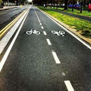
DublinTown view on Liffey Quay cycle path
Summary
Dublin Town’s primary concern is to ensure that as many people as possible who wish to visit the city can access it in a reasonable and convenient fashion. We believe that the rights of all citizens and visitors should be considered equally.
In preparing our position in relation to the cycle lane on the North Quays we have sought the expert advice and input of Thornton O’Connor Town Planning and Stephen Reid Consulting Traffic and Transportation and have consolidated their inputs in the following document.
Dublin Town supports improvements in cycle infrastructure. Our support for significant investment in public transport is well documented. We have proposed several measures to reduce car use in the city. We endorsed or raised no objections to Options 1-6 in relation to cycle lane proposals connecting the Phoenix Park to the sea.
Dublin Town would take a proactive approach in assessing how any of these options could be modified to meet objections.
However, we have significant practical concerns in relation to Option 7 now being proposed.
It is noted that the document circulated to the Transport SPC in September states “At present work is in progress on the detailed examination of the traffic diversion, examination of road widths, lane capacity and junction analysis to determine if any improvements are needed on the proposed diversion route.” It is clear more work is required before a far reaching decisions could possibly be made.
Amongst the many unanswered questions and concerns in relation to the proposals are:
- The proposals add almost 15 minutes to journey times taking vehicles on a detour of 1.475km through a series of roads that serve both as prime routes and through residential areas.
- The roads suggested are narrow in places and are already prone to congestion. Adding new vehicles (including cars and delivery vehicles) is likely to make this congestion more pronounced. How is it proposed to avoid the lengthy delays at junctions (the proposals require 3 significant right hand turns)?
- This increase in vehicles through the proposed routes is likely to reduce safety for cyclists on these streets. How are these safety concerns to addressed? As there are schools in the area what specific measures will be introduced to increase the safety of younger cyclists?
- There will be increased crossing of bus lanes by general traffic; what impacts will this have on bus timetables and reliability? There is currently a bus stop on the junction of Ellis Street and Wolfe Tone Quay. Will this stop have to be removed? If it removed there will be a long distance between bus stops, if it remains, it may lead to delays and tail backs in this location reducing bus journey times.
- General traffic will have to cross the Luas Red Line in 2 separate locations increasing the likelihood of collisions on the stretch of track that is currently the most prone to accidents in the Luas system. This is likely to increase delays and withdrawals of service on the Luas Red Line. What assessment has been made in relation to the impact on the Luas system and reliability? How will the necessary conflicts of traffic and trams be managed? If there are additional traffic lights required or changes to the sequencing what additional impacts will this have on traffic flow through the area? It is noted that the College Green Plaza proposal emanated from the considered view that traffic should not cross the Luas Green line. However, in this instance, traffic will cross the Luas Red Line in 2 additional locations. There appears to be an inconsistency in the arguments being proposed.
- Air pollution will be made worse due to the nature of the building line in the proposed route as compared with quays where there is greater opportunity for dispersal of fumes. There is a clear need for a full Environmental Impact Assessment which would include an assessment of the impact of emissions on air quality and also noise in a tight residential area in which there are schools. The area impacted the proposals measures 24 hectares. It is noted that Urban development which would involve an area greater than 2 hectares in the case of a business district, 10 hectares in the case of other parts of a built-up area require a full Environmental Impact Assessment. An application must be lodged with An Bord Pleanála for determination. The elements of an EIS of most interest to Dublin Town are: Human Beings – The proposed development will alter access to many retail areas of national significance. Therefore, we submit that a socio-economic assessment of the impacts on city centre businesses will be required which is of particular interest. Material Assets – The proposed development will significantly alter patterns of private transportation at the heart of the national capital. A traffic impact assessment will be required. Air Quality – The diversion routes will add approximately 10-15 minutes to private car journey times. The implications of these increased journeys need to be considered from an air quality and climate perspective.
- There is limited space available in the area. There is on street residential parking which may have to be removed to provide space for the increased volumes of traffic. The views of residents to significantly increased traffic especially at peak times should be fully considered. Have local residents been consulted adequately on the proposals? At what point will it be considered necessary to withdraw on street parking along the route including that for local residents? What alternative arrangements are being considered in relation to this?
- Dublin Town’s independent research notes a high likelihood of a loss of customers, trade and spend in the city centre area with consequent impacts on employment, rates and tax take. What analysis or consideration has been undertaken in relation to the economic impacts of the proposals? During the research process a majority of respondents noted a lack of information and knowledge in relation to the proposals while some members of the public noted support for the proposals on the mistake belief that buses would run faster along the quays. As there is no proposed change to bus lanes, this eventuality is unlikely.
- What work has been undertaken to address shortcomings in Options 1-6. It is suggested that further analyses of these options be undertaken to address perceived shortcomings.
- Dublin Town believes that there are more appropriate ways of managing car volumes in the city and these should be explored. This could include introducing a levy on employee parking in the city. It is worth noting that 33% of people coming into the city at peak periods use their car while 19% of people at off peak times use their car for shopping and socialising. Thus a higher proportion of a higher number of people use cars at commuter times. This should to be addressed.
- There is a clear need to invest in underground transport. It is no longer possible or practical to get the volumes of people who visit Dublin each day into the city on surface level.
Introduction
Dublin Town has always taken a proactive approach to transport measures for the city. Our views are based on reaching a balance between all transport modes and ensuring that as many people as possible can visit and enjoy their city.
Dublin Town endorsed or raised no objection to Options 1-6 for a cycle lane from Phoenix Park to the sea. However, we have serious reservations with regard to Option 7, which we believe has several practical limitations and defects that need to be further considered.
- Understanding road use along the Quays
The road users on the Liffey Quays vary in terms of trip purpose across the week and at different times, including:
- commuters who are travelling point to point each morning and evening (from home to work, or education, and back again);
- commercial/business travel such as delivery drivers, people travelling to/from meetings;
- a significant level of persons related to the legal profession who are based around the north quays between the Courts;
- people travelling into the City Centre for retail, leisure and other activities;
It should be noted that there will be a proportion of these including tourists and other visitors to Dublin who have arrived by car and who will not be familiar with the diversion routes or the multiple crossings of the Luas line due to the diversion routes.
- Overburdening already congested road space
The proposals envisages diverting traffic through for 1.475km along already congested roads to free up 475m along the Quays for the cycle lane.
While the introduction of measures to improve traffic safety and protect vulnerable road users such as pedestrians and cyclists are welcome, Option 7 generates many significant issues which were not addressed in the September 2016 report to the SPC, which stated as follows:
“At present work is in progress on the detailed examination of the traffic diversion, examination of road widths, lane capacity and junction analysis to determine if any improvements are needed on the proposed diversion route.”
It is of significant concern that this technical traffic assessment work was not completed before presenting Option 7 to the public.
The R805 Blackhall Place and N1 Church Street are already congested routes for long periods of the day carrying not only radial traffic movements in and out of the city, but these also form an existing signed route for traffic between from Heuston to the N2 via Phibsborough and the N1/Dublin Airport via Bolton Street (J29).
Also, as there is a section of Blackhall Place southbound between North King Street and Blackhall Street which is for buses, taxis, motorcycles and cyclists only, and therefore all other southbound traffic from traffic from the Cabra Road corridor travelling via Prussia Street to the N4 and N7 is directed to turn left onto the one-way gyratory formed by North King Street and onto Queen Street before turning either right onto Blackhall Street to access Blackhall Place southbound and cross the Liffey on the James Joyce Bridge, or by continuing on Queen Street and crossing Mellows Bridge and turning right onto Ushers Quay.
There is extremely limited capacity to accommodate additional turning traffic, particularly the junction of Blackhall Place and North King Street (J25) even though it already has a short section of right turn lane and a right turn arrow on the signals, and the right turn from Brunswick Street North to Church Street (J28), which is limited by the predominant north-south corridor and queuing back from the King Street junction (J29), 50m to the south of it.
Furthermore, it is noted that the off-peak travel time for the 475m section of the Quays where it is proposed to remove general traffic from is typically 2 minutes, depending on traffic light sequences, while during peak periods it can be 3-4 minutes. It is noted that although there is only one eastbound traffic lane and one eastbound bus lane for most of this section, it is not normally heavily congested, with the heaviest queuing occurring upstream and downstream of this section.
The diversion route, by comparison is 1.475km, and without adding the diverted traffic (which would increase queuing and delays on the route) it would take at least 5 minutes off-peak, and up to 12 minutes during peak periods.

Typical existing weekday PM peak journey times and traffic speeds on diversion route
(source: www.google.ie)
Clearly adding the diverted traffic onto this route will significantly increase these journey times, and will further increase journey times for other existing traffic using the existing southbound route to Queen Street and Church Street.
- Considerations for Public Transport
- Implications for bus services & cycle safety
There are limited sections of bus lane on Blackhall Place (northbound) and on-road cycle lanes on Church Road, and therefore it is clear that increasing the volumes of general traffic (cars, vans delivery trucks) on these roads will have a detrimental impact on bus serviceability and cyclist safety on both radial routes.
- Specific Implications for Luas Red Line
A key concern is the additional traffic which will be required to cross the Luas Red Line route at two locations: Blackhall Place/Benburb Street, and Church Street/Chancery Street, if following the diversion route, or if following an alternative route to the south side via Queen Street, this traffic must cross the Blackhall Place/Benburb Street and Queen Street/Benburb Street junctions.
Since the Luas commenced operations the section of the Red Line between Connolly and Heuston has had the highest rate of collisions between Luas trams and other traffic due to the multiple points of conflict between these modes.
An RSA summary in 2014 identified the following statistics (from 2005-2014):
- 90% of collisions involving a Luas occur on the Red Line;
- 60% of road vehicle / tram collisions happened on the city centre section of the Luas Red Line between Heuston and Connolly stops;
- The main junctions where road vehicle / tram collisions happened on the Luas Red Line are:
- Benburb St/Queen St
- Benburb St/ Blackhall Place
- Abbey St/Jervis St
- Bow St Crossing.
It is widely accepted (per the RSA statistics) that most collision incidents occur at junctions and are due to Red Light Infringements: due to motorists/cyclists etc. (or occasionally Luas drivers) not observing the traffic signals (breaking red lights) or motorists stopping across the tracks (not clearing the junction), and it is therefore of significance that adding traffic to these conflict points should have been addressed in detail before publishing Option 7.
Luas Red Line issues in this area cause significant travel disruption, with passengers discommoded and having to seek alternatives (bus, taxi or walking options) to get from Connolly to Heuston, in addition to impacting on general traffic flow where a junction has to be closed off and/or traffic diverted while an incident is being dealt with. With the completion of the Cross-City route in 2017, it is noted that this will also impact on additional Red Line passengers who have interchanged from the Green Line at Abbey Street to access the Red Line for travel to Heuston or Connolly.
The introduction of a circuitous route for general traffic will not only increase journey times and congestion but will inevitably add to driver frustration/confusion, leading to increased risk of collisions at junctions and at lane change points approaching turns.
As the Luas Red Line has trams moving approximately every 4 minutes in both directions or on average every 2 minutes, it is difficult to see how the increased general traffic flow can be accommodated. This is likely to give rise to delays at the intersections of the road and Luas, with knock on effects for traffic within the general area.
It is noted that the decision to create a proposed College Green Plaza came about as it was felt impractical to have traffic cross the Luas Green Line at College Green. However, it is now proposed to have traffic cross the Luas Red Line in 2 additional locations. It could be argued that there is an inconsistency in the approach being adopted in both scenarios.
- Potential for increased collisions
The increase in general traffic movements across the Luas Red Line increases the potential for collisions between general traffic and the Luas.
An increase in driver frustration due to longer routes and increased delays will typically increase the rates of collision incidents between different road users along the route. It should be noted that in terms of commuter/commercial business traffic, many existing users have no viable or practical alternative to driving, if travelling in from outside the city or using their vehicle for work related travel during the day.
Also, for delivery drivers, the diversions will impact on their ability to move around this area of the city without incurring delays which affect their business and the business of their customers.
These road users with no alternative are a captive market who cannot switch modes to public transport or cycling and will therefore continue to drive irrespective of the cycle scheme measures that the Council are proposing to implement.
- Environmental concerns
The impact on residential amenity due to the diverting of additional traffic along streets which have residential uses facing onto them has to be taken into account.
It is noted that the section of Ellis Quay/Aran Quay, while ranging from 3-5 storeys along the north side of the road, is quite open to the Liffey side, with a distance of c.65m to the building line on the south quays. Therefore, traffic noise and air pollutants from vehicle emissions can disperse readily.
In contrast, the width between buildings on Blackhall Place and Church Street is typically 18-20m, while on North King Street it is 12m, and between 13-16m on Brunswick Street north.
These streets along the diversion route have a range of building types, from traditional two-storey terraced dwellings and three storey townhouses, with front door access directly onto the pavement, to more recent apartment/commercial buildings of 4-6 storeys, many of which have a building line to the rear of the pavement.
It is acknowledged that there are some intermittent ‘gaps’ in the building line where there are setback buildings, and there are several empty sites, but these latter are likely to be redeveloped in the future (probably at 4-6 storey heights). Therefore, most of the route will be in a ‘canyon’ between 12 and 20m wide between buildings, which if modelled using standard techniques, would be shown to reduce the dispersal of airborne pollutants, and results in reflective road traffic noise from the buildings.
It is considered that adding traffic and resultant congestion (standing queues/slow moving traffic) onto these streets will have significant negative impacts on air and noise pollution.
The proposals clearly need an Environmental Impact Assessment to evaluate the impacts on residential areas and school environments.
We submit that the Liffey Quays Cycle Scheme (Option 7) comprises urban development over an extensive area of the core of the business district and is of a class that requires an Environmental Impact Statement (EIS) to be prepared.
EIA requirements derive from EU Directive 85/337/EEC (as amended by Directive 97/11/EC) on the assessment of the effects of certain public and private projects on the environment. The Directive was fully transposed into Irish law and EIA legislation as it relates to the planning process and is now facilitated in Part X of the Planning and Development Acts 2000-2015 and Part 10 and Schedules 5, 6 and 7 of the Planning and Development Regulations 2001-2015. Part 1 of Schedule 5 of the Planning and Development Regulations 2001-2015 lists projects included in Annex I of the Directive which automatically require EIA. Part 2 of the same Schedule outlines thresholds for other projects which also require EIA, per Annex II of the Directive.
Schedule 5 of the Planning and Development Regulations 2001-2015, identifies projects of a class that require an EIS and includes:
10(b) (iv) Urban development which would involve an area greater than 2 hectares in the case of a business district, 10 hectares in the case of other parts of a built-up area and 20 hectares elsewhere. (In this paragraph, “business district” means a district within a city or town in which the predominant land use is retail or commercial use.)’
As the subject development directly and indirectly affects an area of approximately 24 hectares in a business district (see Figure 4.1 below) in our opinion an EIS is required.

Figure 4.1: Approximate Area Affected by Subject Proposals
(Source: www.myplan.ie with indicative boundary annotated by Thornton O’Connor Town Planning, 2016)
However, it is possible that a case could be made that the subject proposal represents a ‘subthreshold’ development. There is specific guidance on this matter provided in Schedule 7 of the Planning and Development Regulations 2001-2015 which includes reference to the need for an EIS being determined by three considerations:
- Characteristics of Proposed Development;
- Location of Proposed Development
- Characteristics of Potential Impacts.
We submit that there is a potential for likely significant effects to arise in assessing the three considerations as summarised below:
Characteristics of Proposal– The size of the proposed development which involves the carrying out of works as well as the change of the character and intensity of use over an extensive area of the city centre business district. The proposal will directly and indirectly affect a significant portion of the city centre and will interact and affect businesses such as retail, parking, transportation etc.
Location- The environmental sensitivity of geographical areas likely to be affected by the proposed development, having regard in particular to the existing land use, because the land-uses in the area which include retail and commercial uses are sensitive to changes including road layout, access and mobility.
Characteristics of Potential Impacts- The potential significant effects of the proposed development in relation to criteria set out under paragraphs 1 and 2 above and having particular regard to the extent of the impact (geographical area and size of the affected population), because the proposed development will directly and indirectly affect a significant portion of the centre of Dublin and the probability of the impact, because the extent and scale of the effects are very likely to occur. The impacts are likely to be long-term and permanent.
Therefore, in our opinion there is overwhelming evidence that an EIS is required to properly assess the impact of the proposed development. We note that in such a scenario, an application must be lodged with An Bord Pleanála for determination.
DublinTown is particularly interested in the following sections of any EIS to be prepared:
- Human Beings – The proposed development will alter access to many retail areas of national significance. Therefore, we submit that a socio-economic assessment of the impacts on city centre businesses will be required which is of particular interest to Dublin Town members;
- Material Assets – The proposed development will significantly alter patterns of private transportation at the heart of the national capital. A traffic impact assessment will be required.
- Air Quality – The diversion routes will add approximately 10-15 minutes to private car journey times. The implications of these increased journeys need to be considered from an air quality and climate perspective.
Indeed, the newly adopted Dublin Development Plan 2016-2022 further states the following in respect of projects identified in the Transport Study:
‘Any City Council approved project identified in the study will be subject to full Environmental Impact Assessment in order to clearly ensure that the anticipated effects on the environment are measured………… The Council will ensure that all developments relating to movement and transport infrastructure are subject to Article 6 EU Habitats Directive Assessment to ensure that there are no likely significant effects on the integrity of any European Site(s).’
In summary, having regard to fact that the proposal comprises urban development over an extensive area of the core of the Central Business District, we submit that the project is of a class that requires an EIS. We note that it is possible that a case could be made that the subject proposal represents sub-threshold development. We note that even if the subject development is considered to be sub-threshold that the development is likely to have significant effects on the environment and therefore an EIS should be required.
It is further submitted that the subject proposal should be subject to Article 6 EU Habitats Directive Assessment to ensure that there are no likely significant effects on the integrity of any European Site(s).
- Broader Transport Policies
Chapter 8 of the Dublin City Development Plan 2016-2022provides policy relating to Movement and Transport. The Plan states that the Development Plan supports the need for a City Centre Transport Study. The Development Plan states that such a Study would have the following purpose:
‘Set down a framework for how the City’s transport network can be redefined to cater for increased usage, by better utilising infrastructure available, and moving towards a more sustainable and efficient use of public realm in the city centre, but will have full regard to the protection and development of employment, the economy and cultural vibrancy within the city centre.’
We wish to point out that it appears from the wording of the policy above, that such a study will present more of a holistic approach where the aim of improving the City’s transport network will be considered but that the protection and development of employment and the economy will be a fundamental tenet of any proposals. DublinTown would specifically welcome such an all-encompassing approach.
- Schools and residences in the area
There is the Richmond Centre and St Paul’s CBS on Brunswick Street, which generates school student activity on weekdays. Consideration has to be given as to how the proposals will impact on these schools.
Streets such as North Brunswick Street have on street car parking available for residents. These roads are narrow and congested and therefore, are likely to find it difficult to accommodate the increased traffic flows. This is particularly exacerbated when the number of right hand turns required along the route are taken into accounts. Are residents going to lose the option of parking their cars outside their residences?
- Economic impacts
While typically less time sensitive than commuters, a diversion of 15 minutes to a journey coupled with a circuitous diversion route, is likely to lead to a decision visit and out of town shopping centres rather than a city centre store.
In testing the possible impacts with the public through research conducted by Red C, Dublin Town found that the public were unaware of the proposals and that more than half could not say whether they liked the proposals or not as they didn’t have enough information. Indeed, of those who expressed a view that they favoured the proposals the main reason was a mistaken belief that buses would run more quickly. However, as no additional space is being allocated to bus lanes, this is highly unlikely to be the case. Indeed, given the positioning of bus stops, the bus system may suffer reduced speeds.
Notwithstanding the lack of clarity amongst the public, the survey did demonstrate worrying trends which strongly indicate that city centre stores stand to lose custom due the proposals. When considering movements from the west of the city surrounding counties the following information was obtained in relation to proposed visits:
| More likely to visit city centre | Less likely to visit city centre | |
| For retail | 18% | 39% |
| For shopping | 19% | 32% |
| For business purposes | 9% | 21% |
Those showing most tendency to stop visiting the city were car drivers, the customer profile which spends most per trip.
In this context, it was not surprising to note that over 70% of Dublin Town members when surveyed were opposed to the proposals as they fear, with some considerable reason, that the proposals will have negative impacts on trade.
There is a growing sense amongst the business community and the wider public that there is a plan to remove all cars from the city centre. The current proposals add weight to such concerns. Access by car is important for many business ventures. 19% of people coming into the city to shop and socialise come by car. Their spend is disproportionately high. A person travelling by car spends on average €117 compared to €63 by a bus passenger and €36 for a cyclist. Cyclists account for 4% of customer numbers.
When all the various factors are taken into account it can be seen that 31% of spend in the city comes from car drivers; 38% from bus passengers but only 2% from cyclists. These figures are averages. For certain businesses e.g. department stores and high end goods the spend by car is closer to 40%.
- Reducing cars volumes within the city centre
Dublin Town agrees that car volumes need to be reduced in the city. We believe that Dublin should follow the lead of other cities and charge a levy for the provision of free employee car parking. There are an estimated 10,000 public sector car parking spaces in the city centre, an equivalent of the number of car parking spaces available in multi-story car parks. Nottingham City Council recognising that it had the largest car park in its city introduced a levy on such spaces to be paid by the employer who can pass on the charge to the employee. The funding received through this process is used to upgrade public transport.
Dublin Town is also on the record calling for significant increases in investment in public transport. It is clear that we are well beyond the point where we have to go underground. We cannot fit all the competing transport requests above ground. The Business Improvement District alone has an average daily footfall of over 325,000, this cannot be accommodated above ground. Adequate investment in underground public transport must be made now.
- Consideration of arguments in favour of the cycle lane proposal
Dublin Town is not against the concept of a cycle lane to concept Phoenix Park to the sea. We raised no objection to Options 1-6 but we do have serious reservations around the practical implications of Option 7. A number of specious arguments have been made in favour of Option 7 which we would challenge:
- The proposals will not yield additional customers or boost the local economy. The opposite is the case. Motorists make up 19% of those in the city to shop while cyclists account for 4%. Leaving aside the fact that motorists on average spend €117 per trip as opposed to €36 for cyclists, it is clear that favouring cyclists over motorists will lead to a reduction in the numbers of people in the city.
- The proposals are not likely to have a positive impact on pollution. Again, the opposite is likely to be the case. Due to the wide open spaces along the Quays fumes are easily displaced. This is not the case in the confined space now proposed for those vehicles.
- The proposals do not improve public transport. There are no additional bus priority measures. In fact bus lanes will be crossed by other vehicles and increased congestion along the proposed route may well lead to increased travel times for all vehicles, including public transport in the area. There is a bus stop on the corner of Ellis Street and Wolfe Tone Quay. If this remains buses will be delayed when a bus stops there. If it is removed there will be either too short or too long a gap between bus stops at this important juncture. The Red Luas Line will be crossed on 2 additional occasions which is likely to give rise to issues and increased collisions in this area.
- It is impossible to say that public realm will be improved. We have seen no plans in relation to public realm.
- The plans are unlikely to attract world leading companies. These companies will want access to their premises by all modes of transport. Given proposals for Eden Quay and the current cycle lane proposals it is going to be very difficult to maintain car access to the docklands. This makes investment in the area less attractive and not more attractive.
- Conclusion
Dublin Town has always drawn a balanced approach to transport and traffic proposals. However, the current cycle lane proposals leaves many unanswered questions that need to be resolved. It is a case of ideology taking precedence over practical considerations. We advocate further analysis of the proposals and the undertaking on and Environmental Impact Assessment in relation to the increased traffic volumes through residential areas.